Member-only story
Designing A Map For UNESCO World Heritage Site
My first actual project after graduating from a design school was designing maps.
An initiative for the appreciation of historical monuments of Delhi, India. The Qutab Minar Complex, Delhi, India. It is counted amongst the monuments and archaeological sites of national importance, representing the remains of ancient habitation and culture.
The problem most Indian heritage sites face
- The lack of good maps, inaccurate information, stories made up by local guides and tout defaced plaques/plates inadequate basic infrastructure. These often welcome tourists to most Indian heritage sites. For example, much of Delhi’s history is in crowded complexes with numerous buildings as dynasties have built new structures beside and over older ones. But lack of proper information is just making them hollow monuments.
- The years of erosion, damage, and subsidence make it nearly impossible to visualize what the original monument might have looked like in all its pristine glory.


Qutab Minar Complex in present times.


Authors image: Exclusive permission to the Central Archaeological Library and National Museum Library for research work.
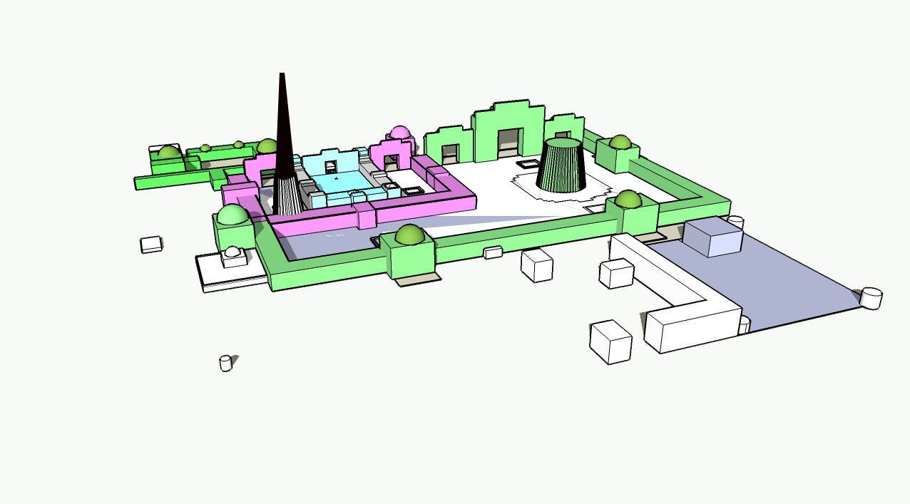
My solution to creating an informational product that disseminates historical and cultural information to visitors
It was to understand and appreciate the original architectural design of monuments. So we decided to give heritage sites in Delhi a detailed reconstruction via 3D illustrative maps.
- I am using text and illustrations.
- The 3D maps include the smallest of details.
- Such as a guide to various dynasties and kings at the bottom of the map.
- A four-fold map was zeroed down, which is handy and user-friendly.
- The content doesn’t follow a strict…

